|
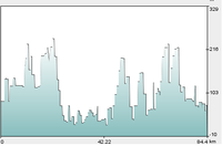
Could you explain which parts of the ride thy are please? I thought they were in order but the first one looks to cover 391km. Am I being thick? |
|
|
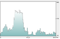
No, your not being thick. Each picture is linked to from the timetable. So they only make sense from their really. The first one is the whole ride of 391k with preference to cycle routes. The timetable is on the wiki front page now. They had to be in a gallery somewhere. :o) |
|
|
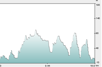
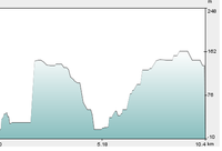
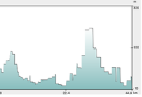
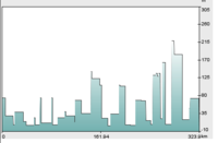
I don’t understand – what are these graphs showing? |
|
|
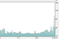
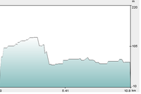
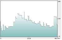
They are just for fun. (Apart from the first one) they show each days altitude changes based on the scenario where we stay on national cycle routes most of the time. |
|
|
So where it goes up, we’ll be cycling uphill, and when it goes down we’ll be cycling downhill? Days 2 and 3 look good; 7 & 8 look scary, but we’ll be well fit by then anyway. |
|